|
 By
installing IMAlign on a second computer we
would have the possibility - as already practised in Strasbourg - to
align the single scans to a complete model already during the survey
session. This way, we could speed up the measurement. By iterating
calculations, the orientation of single scans can be improved
afterwards, till a convergency of 0,00001
mm is reached. By
installing IMAlign on a second computer we
would have the possibility - as already practised in Strasbourg - to
align the single scans to a complete model already during the survey
session. This way, we could speed up the measurement. By iterating
calculations, the orientation of single scans can be improved
afterwards, till a convergency of 0,00001
mm is reached.
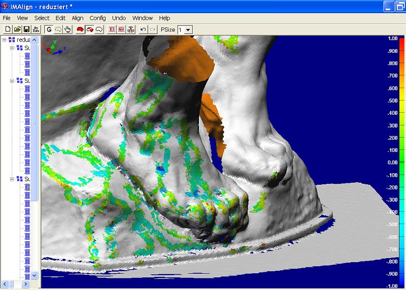
This
module can also filter away the redundant data where two patches have
overlapping areas. The data that were recorded under an optimal angle or
with the highest resolution, are stored, while superfluous data with
inferior resolution are removed from the combined point cloud. The
software does not calculate the mathematical mean between accurate and
less accurate data, but selects the most exact data with preference, to
build the most precise virtual model possible. The selected patch areas
finally have an overlap as small as 4 mm, for example.
With
Polyworks
Inspector, we can measure and visualise possible gaps between
adjacent patches, These ruptures can be smoothed out later by using
IMEdit.
Using
IMMerge, the - now cleaned up - point clouds can be
transformed into polygon meshes very efficiently, creating a grid of triangle
surfaces.
With IMCompress, these meshes can be further
reduced, while considering the curvature of the surfaces. The total amount of
data is reduced, but finest details and sharp edges still remain visible and
crispy.
With
IMEdit, the polygon meshes can be edited and retouched. Small
holes can be filled automatically or using arched Beziers surfaces
(NURBS), so that the filling patches are optimally adapted to the
surrounding surfaces. This way, naturally modelled surfaces can be
created. A deviation from actually measured data can not be detected
with the bare eye any more.
|

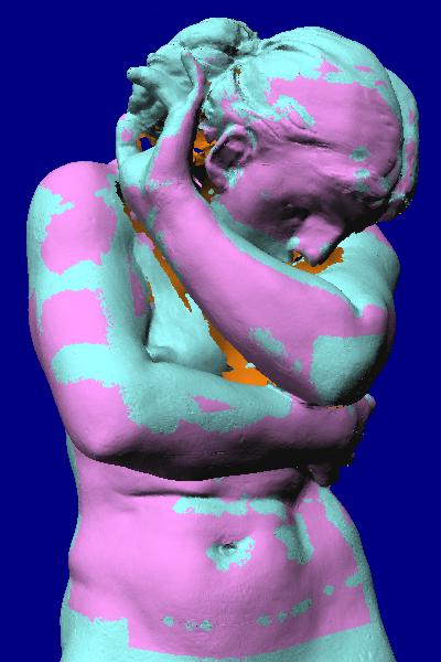
Sorting the scans into subgroups representing different
resolutions, IMAlign picks the best data available and discards redundant data
of inferior quality or resolution.
|